

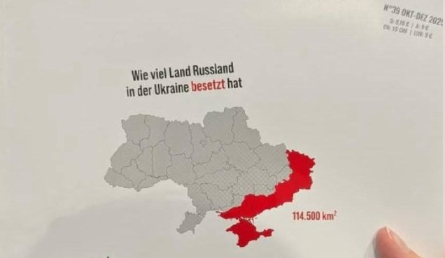
The German magazine "KATAPULT" has demonstrated how Ukraine's territorial losses would look on the maps of other countries. This exercise allows for a clearer understanding of the conflict's scale and its potential global impacts. The magazine's approach visually presents the geographical impact of the war, drawing readers' attention and encouraging them to delve deeper into the issue.
Redaksiya reports that "KATAPULT" has shown the territories "liberated" by the Russian Armed Forces on the maps of France, Germany, Italy, Spain, Poland, the USA, and several other countries. These depictions demonstrate that the war's impact is not limited to Ukraine but could also encompass the territories of other countries. This approach emphasizes the global impact of the conflict and draws the attention of the international community to this issue.
Specifically, in France, these territories cover almost all of Normandy and a part of the Paris region; in Poland, half of Mazovia; and in Germany, all of Brandenburg and Berlin. This visual presentation shows how extensive the potential impact of the war could be. In 2023, the magazine wrote that the area of territories then seized by Russia was equivalent to the combined areas of the states of Bremen, Lower Saxony, North Rhine-Westphalia, and Saxony-Anhalt. The publication notes that "Bremen, Lower Saxony, North Rhine-Westphalia, and Saxony-Anhalt. The area of these four federal states is 102,698 square kilometers, while the area of the occupied territories in Ukraine is 102,629 square kilometers." This comparison helps to understand the scale of the war's territorial losses more clearly. The "KATAPULT" magazine's approach, by visually presenting the impact of the war, draws readers' attention and encourages them to delve deeper into the issue.